|
|
| 
 |
|
Light level geolocation is the method of using measured ambient light level (solar irradiance) to establish geographical location using astronomical algorithms. To record light data, our geolocators contain a battery, small computer, memory and an accurate clock. Generally, two positions per day can be obtained.
Longitude (how far east-west) can be determined because the Earth spins in its orbit around the Sun. The usual method to establish longitude is to first establish the time of local noon or local midnight. This is the time midway between sunrise and sunset, or between sunset and sunrise for noon and midnight respectively. If the time of sunrise and sunset are determined by the same light level, and the amount of solar light attenuation (e.g. shading) is equal at these times, knowledge of Sun position is unimportant. What is important is to have a time reference to an accurate clock. Invariably, for a number of reasons, longitude is more accurately determined than latitude for light level geolocation.
Latitude can be determined because the Earth's spin axis is tilted in relation to its orbit around the Sun which is the reason we have seasons. Latitude is trickier to calculate but is often determined by day or night length. This is the length of time between sunrise and sunset, or sunset and sunrise, respectively. For this measure of duration to be useful, the elevation (altitude or zenith) of the Sun at sunrise and sunset is required. Therefore, a relationship between the light level recorded and solar elevation is needed. Note that 'sunrise' is simply the name given to the time at which the Sun is at a certain elevation during dawn; this does not have to be the official 'sunrise' time that one would find, for example, in a newspaper. Likewise, for 'sunset' during dusk. For a number of reasons, the Sun elevation used is usually around about 5 degrees below the horizon.
Light level geolocation is applicable whenever there are periods of night and day. Therefore, close to either pole, the method cannot be used all year around. Due to the rate of change of day length with respect to latitude, latitude accuracy decreases near the equator. Also, due to the lack of variation in day length with respect to latitude close to equinox, uncertainty is large at this time.
Hence, generally, the geolocation method is most accurate for the area of the world between the Tropic of Cancer and the Arctic Circle and the area between the Tropic of Capricorn and the Antarctic Circle. Adequate data can, however, often be gathered well outside of these two ranges.
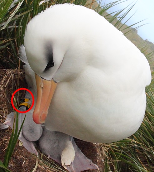
Some models also record other information such as temperature and conductivity. This can help with both activity studies and to aid location determination (e.g. for a shorebird, when the conductivity sensor indicates significant seawater then the bird is on the coast). An Intigeo-C65 geolocator dwarfed by a standard leg ring on a Black-browed Albatross with chick, copyright Jenny James.
 |
|


